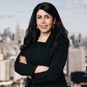
Authors: Mona Hemmati Steve Bowen

Tropical cyclones are the peril that sets the tail of the global reinsurance market. A single landfalling storm can generate industry losses reaching into the tens of billions (USD), correlate damage across hundreds of miles of coastline, and affect multiple lines of business simultaneously.
Yet managing that risk demands more than tracking seasonal forecasts and storm counts — it requires understanding how climate signals interact, how risk redistributes across basins, and where catastrophe models still have room for improvement.
While Hurricane Isaias recently made an October US mainland landfall, the 2026 Atlantic hurricane season has been one of the most meteorologically benign in the official record. But, with a strengthening El Niño still in place, those questions are as pressing as ever — especially as El Niño has already tilted the dial towards a greater frequency of tropical cyclones in the Pacific Ocean.
Dr. Mona Hemmati is Global Tropical Cyclone Peril Lead at Gallagher Re. She took up the role in January 2026, leading the firm's analytical response to the risks posed by hurricanes and tropical cyclones. Trained as a civil engineer with expertise in climate science, Hemmati earned her Ph.D. from Colorado State University and completed three years of postdoctoral research at Columbia University's Lamont-Doherty Earth Observatory.
Prior to joining Gallagher Re, she contributed to the development and implementation of tropical cyclone risk models and climate risk assessment frameworks for reinsurers and international organizations. She continues to serve as a Designated Academic Colleague (DAC) at Columbia University.
Hemmati is one of a group of peril leads within Gallagher Re's Global Property Research team, alongside specialists covering wildfires, severe convective storms and floods. Each is responsible for broad technical oversight of model development and evaluation, and for supporting carriers in making more informed decisions in underwriting, pricing, accumulation management and reinsurance placement.
In this interview, Hemmati sits down with Steve Bowen, Chief Science Officer, to explain what makes tropical cyclones one of the most consequential perils in the global (re)insurance market, what El Niño does and doesn't tell us about hurricane season, what has changed in catastrophe modeling, and how Gallagher Re's capabilities help clients move from a seasonal signal to a risk management decision.
Steve Bowen (SB): Tropical cyclones are one of the most consequential perils the (re)insurance industry faces. What makes them so significant compared to other natural catastrophe risks?
Mona Hemmati (MH): Tropical cyclones stand out because they combine several dimensions that make catastrophe risk particularly difficult to manage.
Start with scale. A single hurricane can, and has, generated insured losses ranging from several billion to more than USD50 billion on a nominal basis. North Atlantic activity can effectively set the tail of the capital requirement for the entire global reinsurance and ILS market. No other weather peril concentrates that kind of loss potential in a single system.
And while the Atlantic dominates the industry's loss experience, the peril is genuinely global — typhoons in the Western North Pacific and cyclones in the Indian Ocean and Australian region all carry the potential for significant insured losses.
Then there is aggregation. Insured coastal exposure across Florida, the Gulf Coast and the Northeast has grown considerably over the past two decades and is heavily concentrated in the zones these storms affect.
The same dynamic is playing out in Japan, Southeast Asia and Australia as insurance markets develop and coastal exposure grows.
Unlike severe convective storms, which produce frequent but scattered losses, a single hurricane can correlate damage across hundreds of miles (kilometers) of coastline and hit property, marine, business interruption, and other lines of business all at once. That makes the peril both expensive to hold and expensive to transfer.
Finally, tropical cyclones are a multi-hazard problem. Wind, storm surge and inland flooding are three distinct physical processes with different vulnerability profiles, coverage structures and modeling challenges. Managing all three together adds a layer of complexity that neither modeling nor coverage structures have fully resolved.
SB: Tropical cyclone risk looks very different depending on where you are in the world. How does cyclone behavior and risk vary across the major basins?
MH: The physics of tropical cyclones are the same everywhere, even if the name changes — what we call a hurricane in the Atlantic is the same meteorological phenomenon as a typhoon in the Western North Pacific or a cyclone in the Indian Ocean and Australian region(s).
Still, the way risk translates into insured losses varies considerably across basins — because climate drivers, exposure profiles, and the level of insurance penetration differs in each of those regions. The Atlantic draws the most attention because of the concentration of insured assets along the US coast. Florida, the Gulf Coast and the Northeast together represent an enormous accumulation of insured property, and a single storm can produce multi-billion-dollar industry losses. That concentration is what makes North Atlantic activity so consequential for the global market.
However, the Western North Pacific is the most active tropical cyclone basin in the world, with nearly twice the annual storm count of the Atlantic. These are the storms that affect Japan, China and the Philippines — and Japan is one of the most significant insurance markets in the Asia-Pacific region, with substantial typhoon exposure.
Australia presents its own significant risk profile. When Cyclone Alfred struck in 2026, it became the biggest single claims event in the history of Australia's national Cyclone Pool, a federal reinsurance mechanism established to address the protection gap in cyclone-prone regions. It was a clear signal of just how real, and growing, the peril is there.
The Indian Ocean and Australian region each have distinct seasonal patterns — and significant loss potential. Consequential cyclone losses are not confined to the Atlantic or Pacific. For any carrier with a globally diversified book, basin-level differences entirely shape the aggregate exposure picture.
SB: How reliable are the metrics the industry uses to track and forecast tropical cyclone activity, and how well do they translate into meaningful loss signals for reinsurers?
MH: It helps to think about this across two distinct forecast regimes, because the sources of accuracy and the uncertainty structure differ in each.
Seasonal forecasts (three to six months ahead) rely on slowly evolving climate patterns, primarily ENSO state and sea surface temperatures in the Atlantic's Main Development Region, where most Atlantic hurricanes form. These signals are relatively predictable but mainly tell us about basin-wide activity. The critical limitation is that seasonal forecasts predict aggregated storm counts and metrics, such as Accumulated Cyclone Energy (a measure of individual storm or seasonal intensity and/or longevity), rather than landfall probability. Landfall intensity and location is ultimately what drives losses. An active season can produce minimal insured losses if storms stay offshore; a quiet season can be catastrophic if even one storm hits a heavily exposed coastline.
In the short-term range — zero to five days before landfall — skill improves substantially. Track forecasting has roughly doubled in accuracy during the past 30 years, although intensity forecasting remains harder, particularly for rapidly intensifying storms, where maximum wind speed increases by at least 34 knots (39 mph / 63 kph) in a 24-hour period.
For example, Hurricane Ian in 2022 went from a Category 2 to a Category 4 storm approximately 16 hours before landfall. That escalation pace is one of the most persistent challenges in the field, and it compresses the window that clients have to prepare for a landfall.
SB: You mentioned seasonal forecasts and ENSO cycles — topics that have been at the forefront of people's minds in the last few months during the Atlantic hurricane season amid forecast strong El Niño conditions — although ultimately, it ended up being a quiet season. Colorado State University's 2026 original outlook called for nine named storms, four hurricanes and one major hurricane, which was still well below the long-term average. How do you think we should approach these forecasts, and is there a risk that (re)insurers can fall into a false sense of security when storms are expected to be below average?
MH: A below-average forecast can certainly create a false sense of security when it's read as a forecast of losses rather than a forecast of baseline activity. Insurers and reinsurers don't incur losses based on the meteorological seasonal storm count. They incur losses from landfalling storms.
Seasonal outlooks should be one input into the risk assessment process, not the framework.
While it's true that the El Niño pattern shifts the loss distribution toward fewer US landfalls, it doesn't eliminate them.
During El Niño years (1950-2025), there is an 85% probability of zero to one U.S. hurricane landfalls, with an average of 1.1 landfalls per year. La Niña years are a different story. Only 43% of seasons see that same quiet outcome — the annual average nearly doubles to 2.2, with a 24% chance of two landfalls, a 19% chance of three and a roughly 15% chance of four or more.
However, a 15% chance of more than one landfall during an El Niño phase isn't a negligible risk. It only takes one landfall. That's why the distribution matters more than the average — the tail is where the most consequential outcomes exist.
In addition, the within-phase variability is large. The 2004 season was a weak El Niño year. It still produced 10 US landfalls, driven by steering flow that funneled storms directly toward the coastline. That season belongs in every portfolio's stress-test reference set for El Niño years.
Hurricane Andrew makes the same point from a different angle. The US saw just one major hurricane landfall that season — and it had one of the largest impacts on the insurance industry in modern history.
We explored this in more detail in a recent thought leadership piece, originally published as part of our H1 Natural Catastrophe report.
So, while 2026 was ultimately a quiet season for the market, it would be a mistake for (re)insurers to take this as a signal of lower risk during El Niño years in future — especially those with a global book outside of the Atlantic.
SB: We've already discussed the global nature of tropical cyclone risk, but when El Niño suppresses Atlantic activity, does overall global tropical cyclone loss potential fall — or does risk shift elsewhere?
MH: It shifts. The Atlantic and Western North Pacific tend to move in opposite directions under ENSO. El Niño suppresses the Atlantic while amplifying the Western North Pacific; La Niña does the reverse. What changes is where those storms occur.
How El Niño affects hurricane season around the world
Data: NOAA and Australia Bureau of Meteorology Graphic: Gallagher Re
The loss picture is less balanced. Historical data from 1990 to 2025 show La Niña phases averaging 113% higher direct economic losses and 186% higher insured losses globally than El Niño phases. Because the Atlantic accounts for approximately 63% of global tropical cyclone economic losses — and an even higher share of insured losses — El Niño's suppressive effect on Atlantic activity pulls global totals down substantially.
However, within-phase variability applies globally as much as it does in the Atlantic. Historical data show La Niña seasons are generally associated with more frequent and more expensive losses — a pattern that should inform how the industry thinks about capital and reinsurance purchasing heading into any given season.
Although it's important to note that El Niño years still carry tail risk that cannot be written off. The phase moves the distribution. It doesn't set the outcome.
SB: How has tropical cyclone modeling evolved over the past decade? Are there any gaps in existing approaches?
MH: Progress is real. Today's catastrophe models are built on better hazard science, higher-resolution meteorological data and richer exposure information than they were a decade ago. The most consequential development is the integration of climate science into catastrophe modeling.
Models are increasingly incorporating climate conditions into their risk view — seasonal signals, warming scenarios — and moving away from a sole reliance on the historical record. That matters because the historical record is a limited sample, and the conditions shaping future losses are not identical to those of the past.
The remaining gaps are in two areas. The first is rapid intensification. How a storm evolves in the final hours before landfall — and what that means for the hazard footprint and loss distribution — is still not captured reliably by most models. It's an area that needs much more focus, and one we are investing in directly.
As part of the Gallagher Re Tropical Cyclone Consortium, established within the Gallagher Research Centre, our partners at Colorado State University have conducted research on rapid intensification and its relationship with various ENSO phases. Their findings indicate that during El Niño, the frequency of rapid intensification events increases significantly in the eastern North Pacific, western North Pacific, and South Pacific, while the North Atlantic exhibits the opposite behavior.
The second is compound hazards. Wind, storm surge, and inland flooding occur together, but they're still modeled largely as separate problems. Precipitation-driven losses from tropical cyclones have grown as a share of total loss, and that trend is likely to continue as the climate warms. Coverage structures and vulnerability assumptions have not kept pace with where the losses are actually going.
Artificial intelligence is also reshaping how the industry approaches forecasting. The National Hurricane Center is already using AI-based forecast models, and track prediction has improved.
However, AI learns from historical data, which means it handles average conditions better than extremes. In catastrophe risk, the extremes are what matter.
The more productive application is AI working within physical and climate science frameworks — not replacing them — so the models can be calibrated against events that have happened rarely or not yet.
No single approach solves this. The best outcomes come from combining catastrophe models, climate science, AI and observational data, with expert judgment applied throughout.
SB: What does your role mean in practice for clients, and what capabilities is Gallagher Re developing to help them manage tropical cyclone risk?
MH: My role is to connect tropical cyclone science with the decisions our clients need to make about their portfolios. A large part of that is helping clients understand what is driving their modeled risk — not just the number itself, but whether it reflects a change in the climate signal, an update to exposure, a model revision, or an emerging loss pattern. That context changes how you act on the output.
On the modeling side, we evaluate vendor catastrophe models with clients — which perform better in which regions, where the gaps are, whether adjustments are warranted — and translate those findings into the metrics that underwriting decisions actually use: AAL, PML and portfolio-level loss distributions.
We are also investing in our real-time event response capabilities. When a storm is approaching the coastline — starting roughly 72 hours prior to a scheduled landfall — we work with Reask to provide clients with early loss estimates so they can begin allocating resources: preparing crews, pre-positioning claims adjusters, and planning for the operational demands a major event creates.
Long-term, the work is about helping clients understand how climate trends are reshaping where risk sits.
But preparing for what lies ahead also means addressing areas where today's models still have limitations.
Through the Consortium, Federation University Australia is examining tropical cyclone-induced flooding and its implications for the Australian market, including the national Cyclone Pool. Vrije Universiteit Amsterdam is focused on post-tropical cyclones — storms that transition from tropical origins and bring severe weather impacts to Europe, a risk that is underserved by current models.
SB: What should clients be prioritizing when reviewing their tropical cyclone exposure, and how can Gallagher Re help?
MH: Three things. First, resist the temptation to read a below-average forecast as permission to relax. A portfolio built around the average El Niño outcome isn't positioned for the outcomes that define loss years.
Second, focus on geography and think globally. El Niño doesn't uniformly suppress risk. It redistributes it. In the Atlantic, our modeling shows Gulf Coast landfall probability suppressed across Texas and Louisiana, while the Mid-Atlantic and Northeast see elevated probability, with double-digit positive anomalies in states like New Jersey and Delaware.
But the redistribution principle applies across every basin. In El Niño years, the Western North Pacific tends to see amplified activity — meaning carriers with Japanese, Korean or Australian exposure cannot take comfort from a quiet Atlantic season. The same climate signal that suppresses one basin elevates another. Understanding where your portfolio sits relative to that shift — not just in the US but globally — is one of the most important questions a carrier can ask as it heads into any El Niño season.
Third, close the compound hazard gap where possible. Storm surge and inland flooding are responsible for a growing share of tropical cyclone losses across every basin — not just the Atlantic. The coverage and claims structures that apply to wind don't always extend to flood, and the modeling assumptions that work for one region don't always transfer to another. Understanding where that gap lies in a portfolio and what it means for loss estimates across different geographies is one of the most practical improvements a carrier can make.
The science in this season is increasingly precise. The question is whether portfolio decisions reflect that precision — or whether a below-average headline number becomes a reason not to look harder. Our team is available to help clients do the former.
Want to learn more about how Gallagher Re can help you understand and manage tropical cyclone risk across your portfolio? Reach out to the team today.